Simplify the environmental data for greater dissemination and sharing
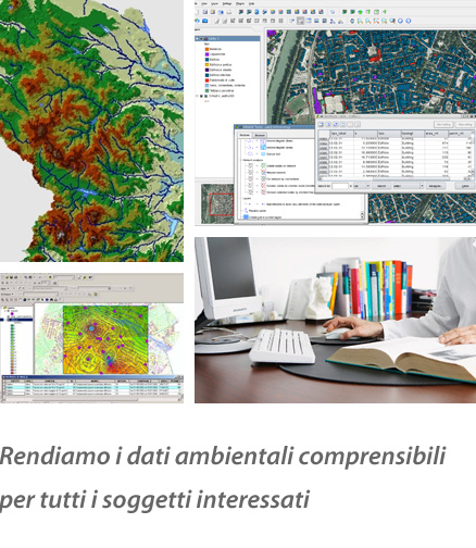
The Geographic Information Systems (GIS) for the management of the environment range from monitoring sites at risk to the management and inventory of water resources, up to analysis and publication on the web of discrete collected data.
Earthwork support to its clients in the implementation of GIS and in the analysis of the environmental dynamics through techniques of remote sensing and spatial analysis.
The WEB GIS Earthwork develops for its customers is a system that allows them to generate complex computations in a simple and intuitive way, allowing the dissemination and sharing of spatial data.
Our services
- Design and Implementation of Geographic Information Systems (GIS) and their publication on the web-oriented platforms (Web GIS) to share information
- Design of automatic reporting with thematic mapDesign and management of cartographic inventoriesBiomass assessment by multi-spectral images
- Contamination assessment of soil and surface water
- Elevation models
- Monitoring of desertification processes
- Urbanization control and land use
- Integrated management of agricultural development
We make environmental data understandable to all stakeholders
25 October 2011